Project Portfolio
Here are some samples of my personal projects that I have completed using ArcMap, ArcGIS Pro, ArcGIS Online, HTML, CSS, JavaScript (D3, Leaflet.Js), Git, Github, and Adobe Illustrator. Click on the Read More button under each thumbnail to learn more.
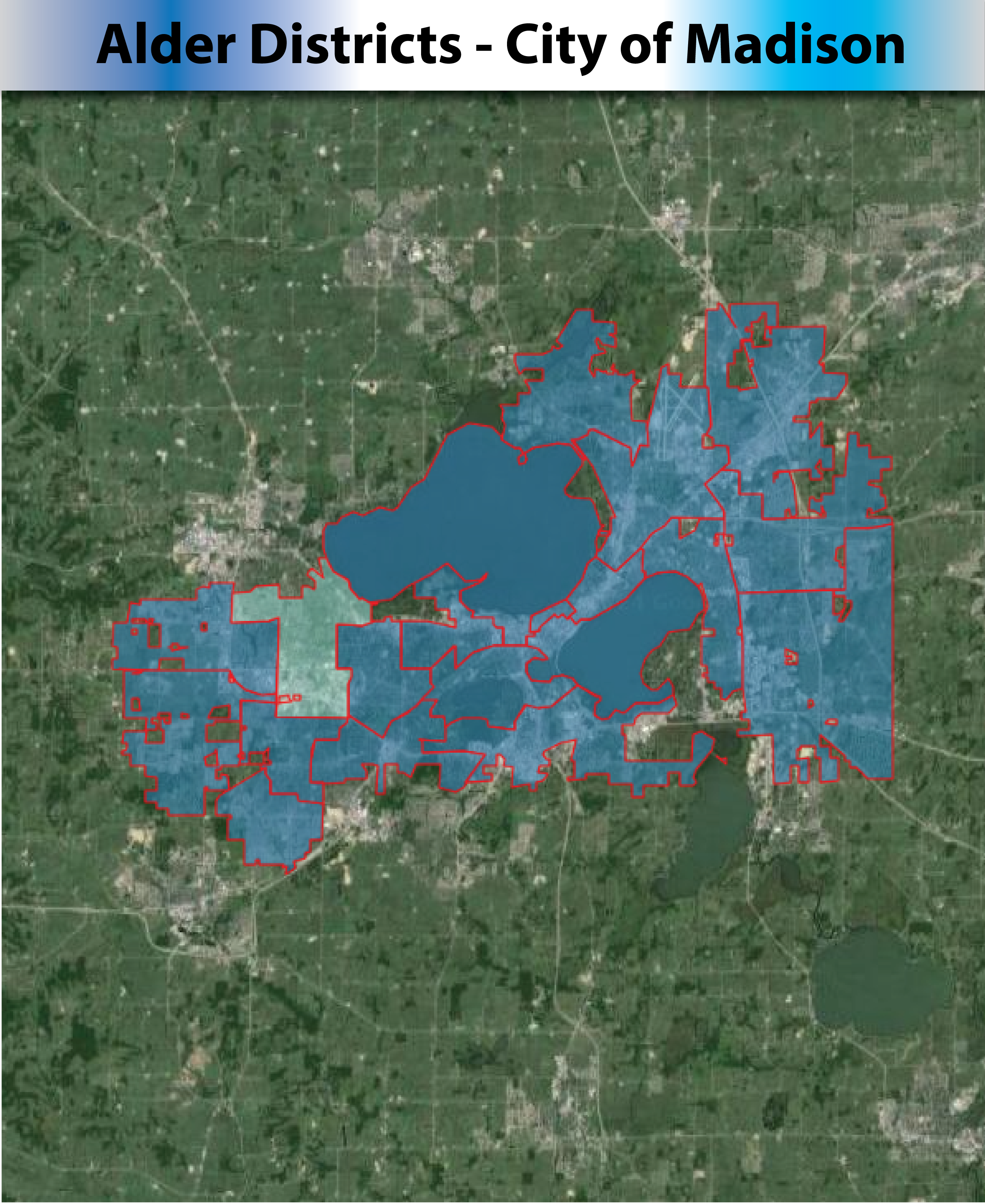
Alder Disricts - City of Madison
This interactive map will help users to find their district alder.
Read More
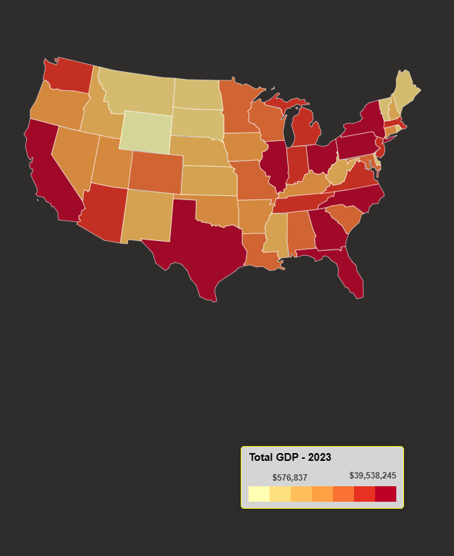
U.S GDP By State - 2023
Click on any state to see the 2022, 2203 GDPs, GDP growth, counties' GPD and more.
Read More
Worldwide Education Ranking
Why U.S Middle Schools Students Scored Below the Average in Math?
Read More
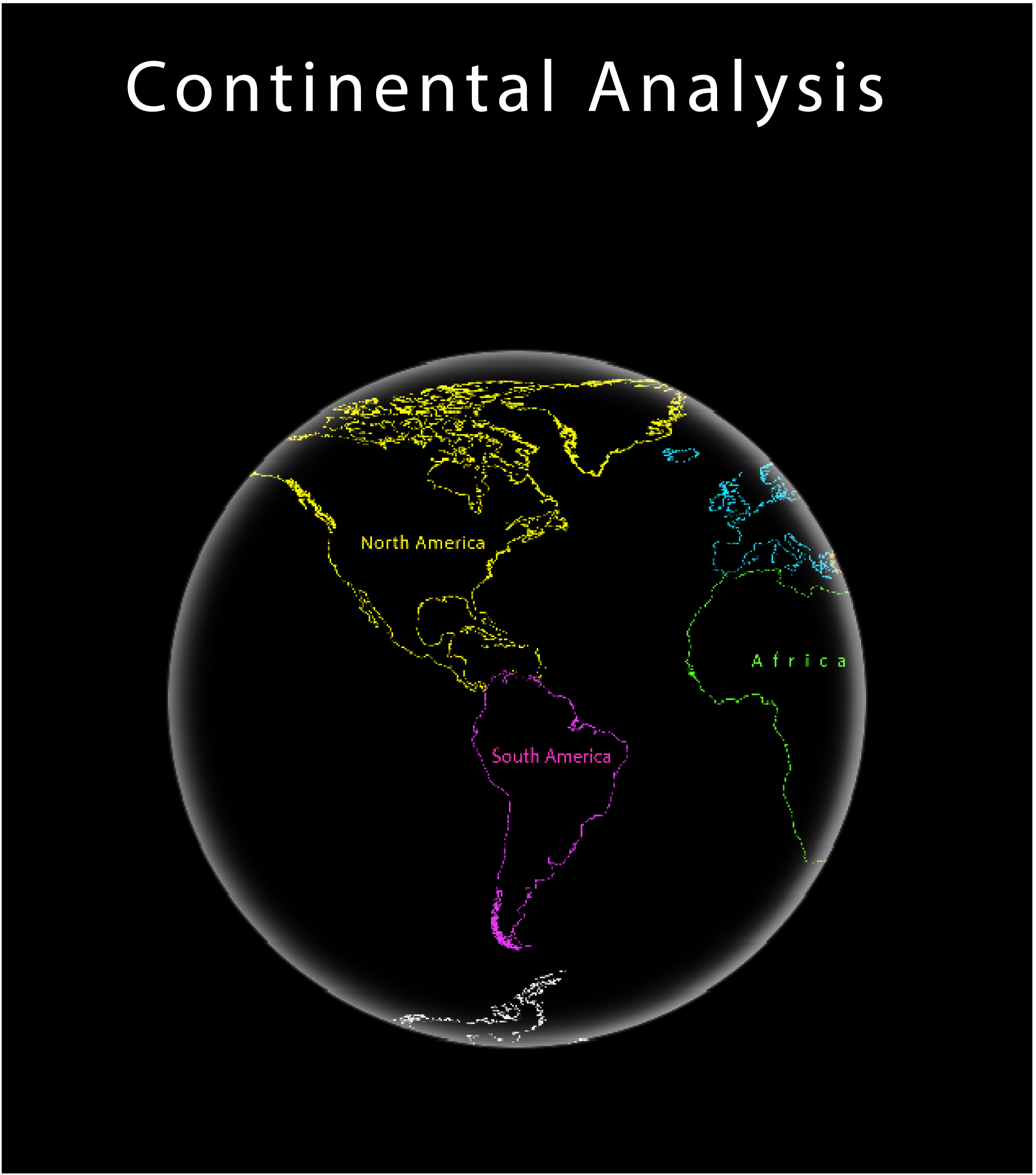
Continental Analysis
The 7 continents, their population, population density, GDP and GDP per capita.
Read More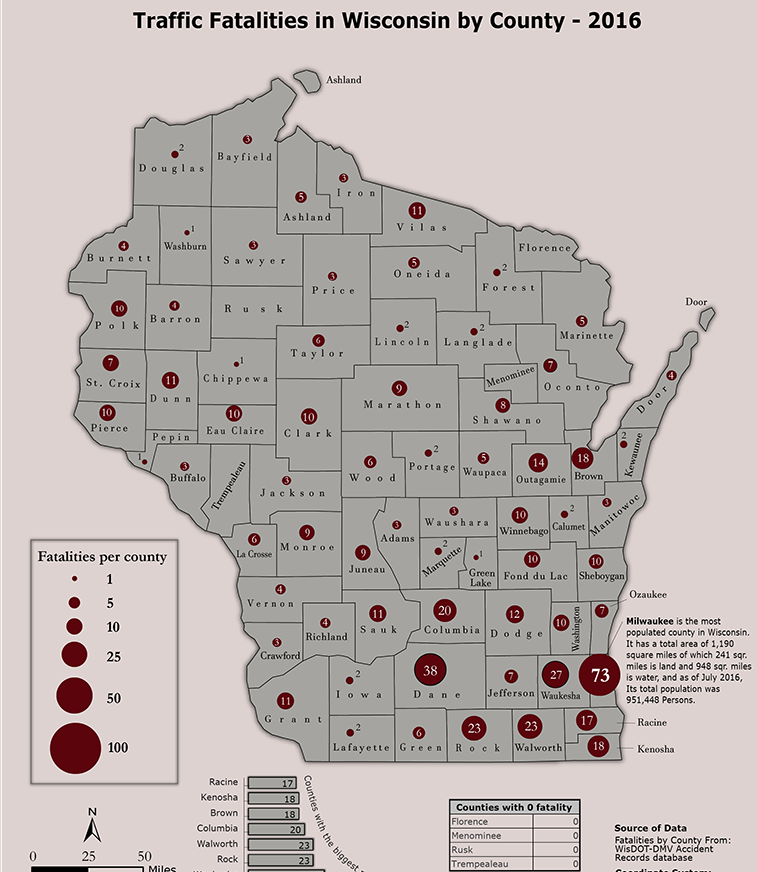
Traffic Fatalities by County
This proportional symbol map shows traffic fatalities in Wisconsin.
Read More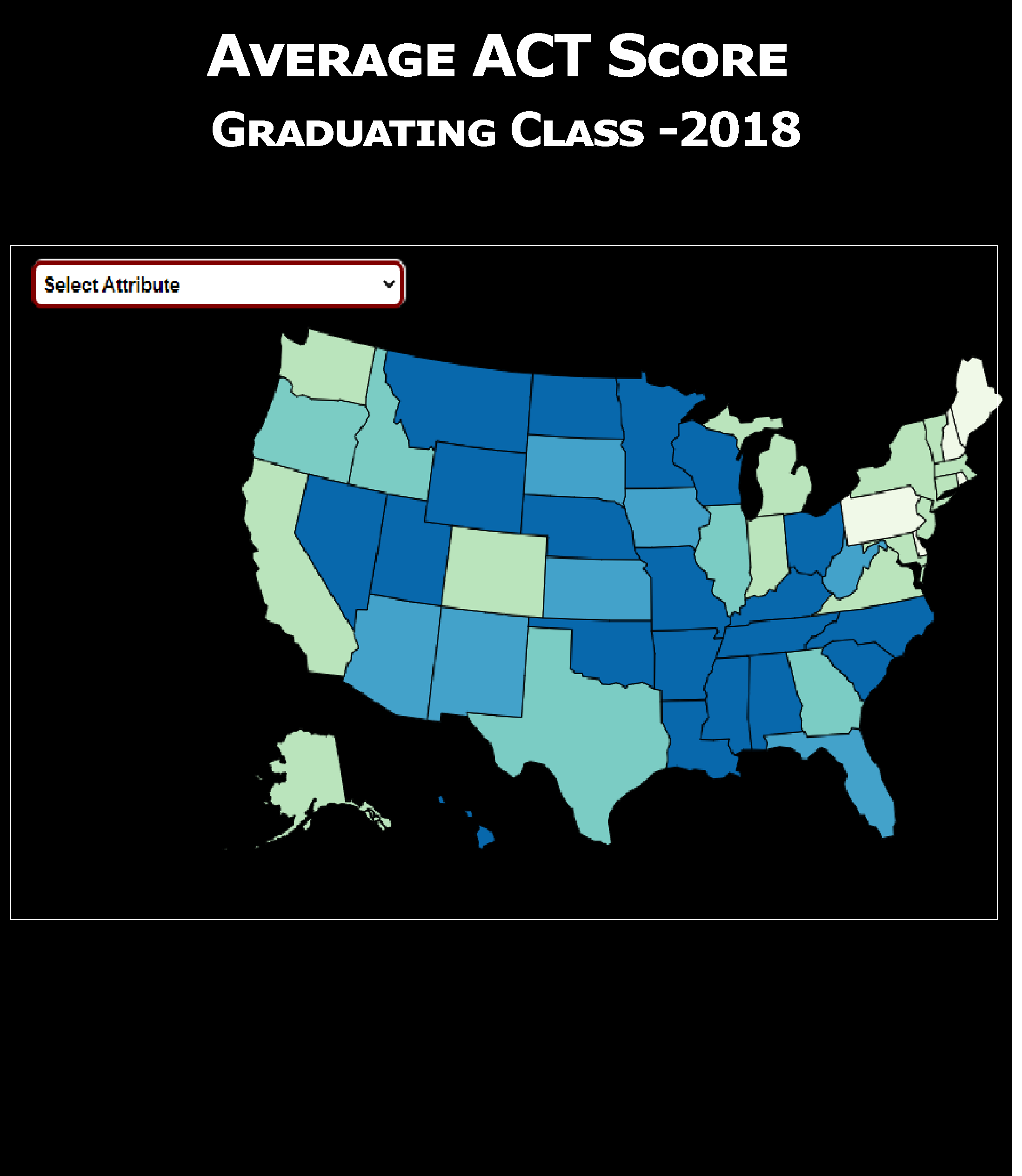

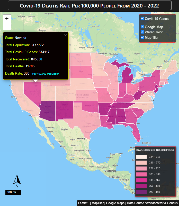
Covid-19 Deaths Rates 2020-2022
This map shows estimated depth-to-bedrock in the state of Wisconsin.
Read More
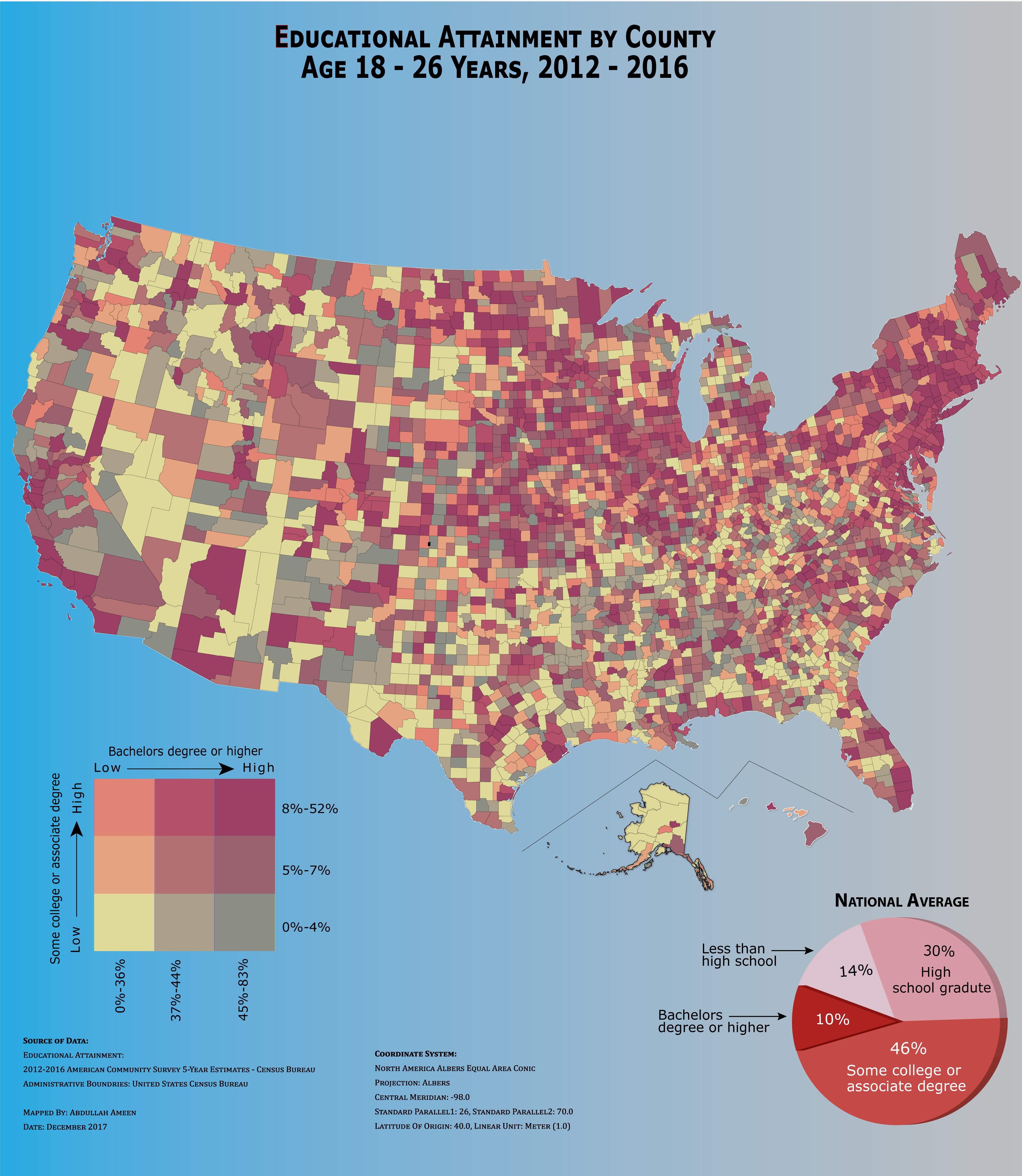
Educational Attainment by County
Bivariate Choropleth maps present two numerical varaibales into a single map.
Read More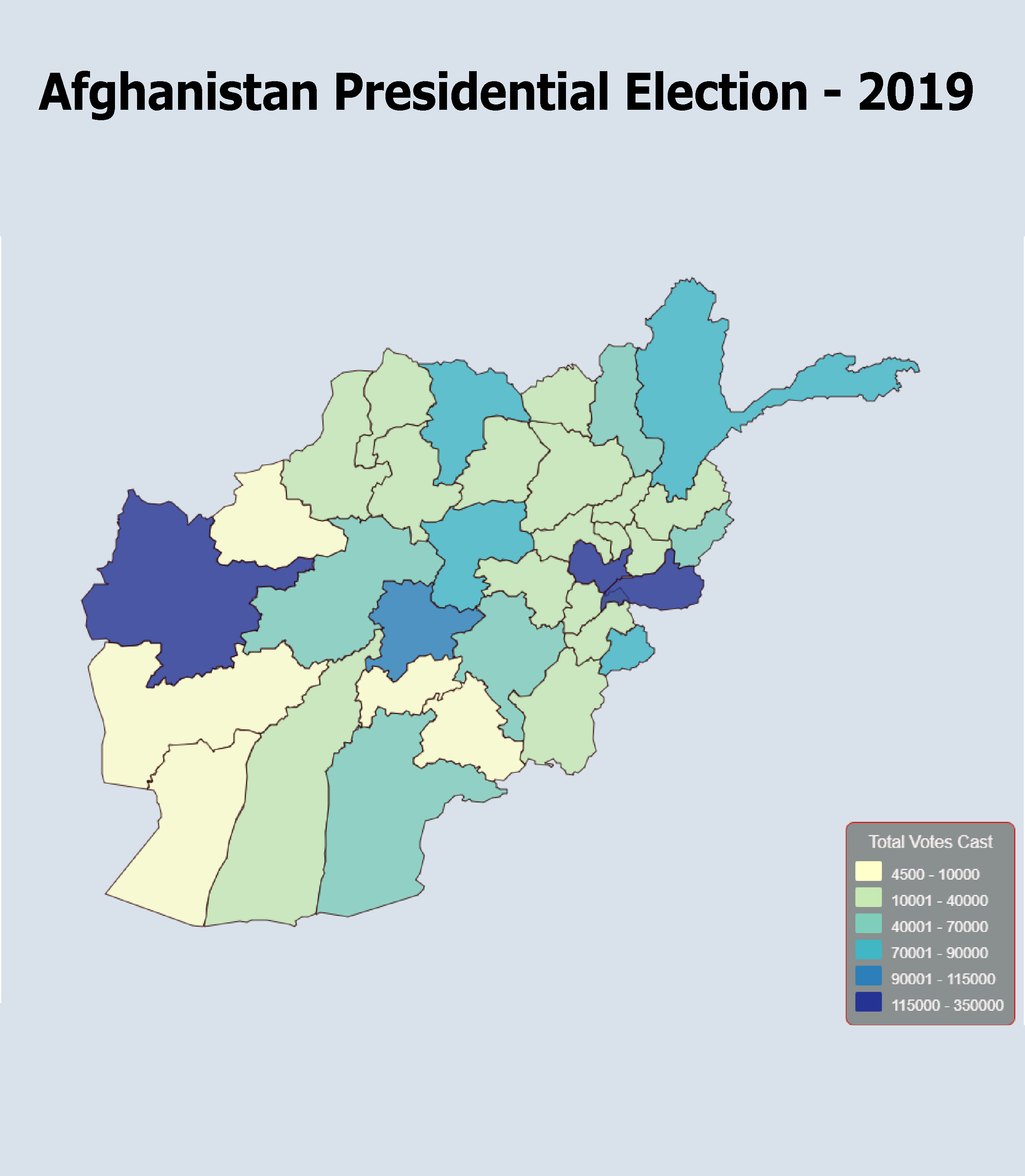
Afghanistan Presidential Election-2019
This Interactive Web-Map is made in Leaflet.js (JawaScript Librar)
Read More
Infographic - Vector PNGs
Did you need free icons for your buisness, website or student projecjt?
Read More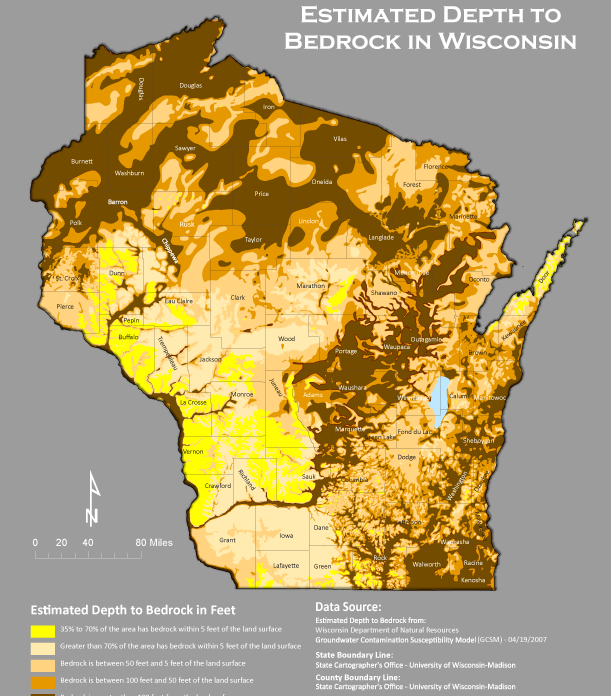
Estimated Depth to Bedrock
This map shows estimated depth-to-bedrock in the state of Wisconsin.
Read More
Terrain Representation
This map is made in ArcMap, Adobe Photoshop and Adobe Illustrator..
Read More
Islamic Centers in Wisconsin
This map shows estimated depth-to-bedrock in the state of Wisconsin.
Read More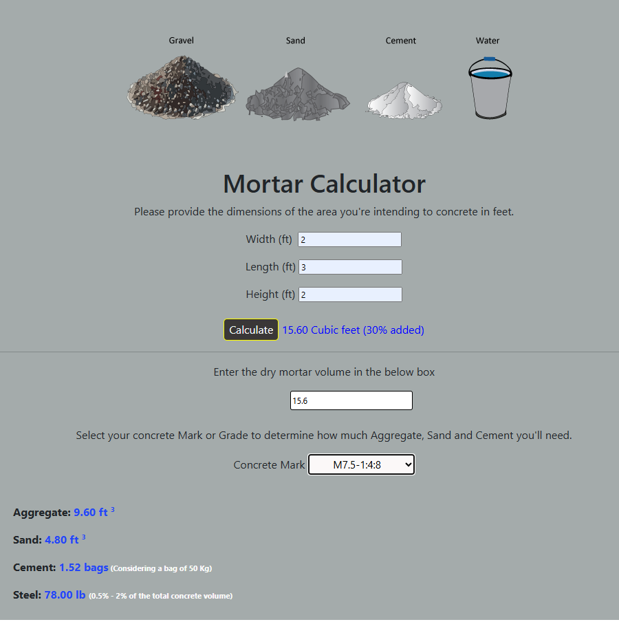
Mortar Calculator
This calculator aids civil engineers in determining the amount of steel, cement, sand, and aggregate.
Read More
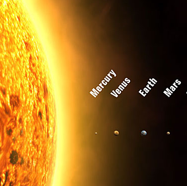
Our Solar System
Our solar system has one star (The Sun), and eight planets (Mercury, Venus, Earth, Mars, Jupiter, Saturn, Uranus, and Neptune).
Read More